The National Weather Service at Little Rock has this update as of 3 p.m., December 31, 2021:
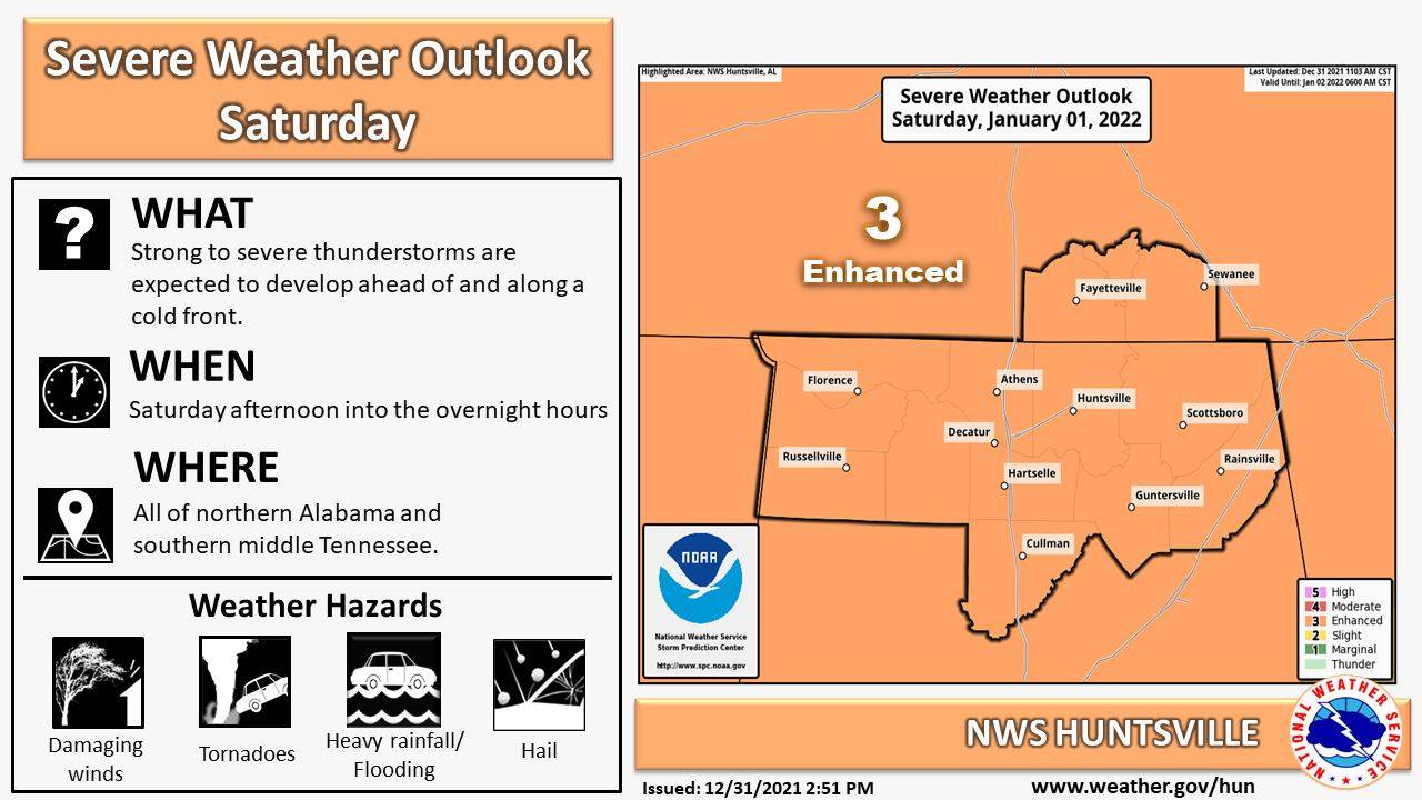
Here is the latest with the severe weather threat for Saturday. Strong to severe storms are expected to develop tomorrow across the area. All modes of severe weather are possible including damaging wind gusts, hail, and tornadoes. Some tornadoes may be strong.
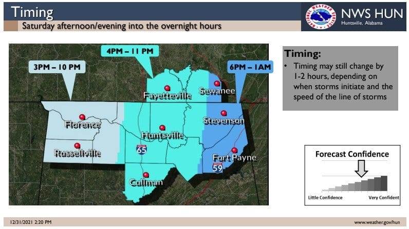
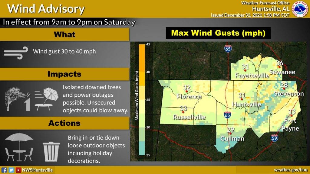
Taking a closer look at the timing: Thunderstorms will develop as early as 3pm. Supercells that form in the mid/late afternoon pose the greatest risk of producing tornadoes. A squall line moves through the area in the late evening from west to east. Not only is there a chance for severe storms on Saturday, but winds will be quite gusty throughout the day. As a result, a wind advisory has been issued from 9am-9pm with winds gusting between 30-40 mph.
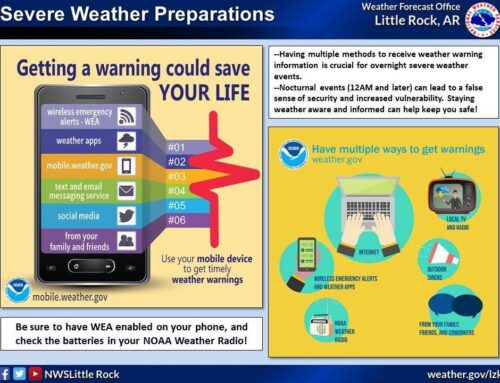
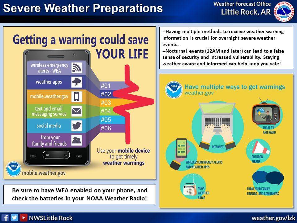
- Be prepared in advance of severe weather!
- Know where you are on a map
- Make sure your emergency kit is ready to go
- Check your weather radio is working
- Know what actions to take when a watch or warning is issued
- Stay updated as timing or hazards may change #HUNwx
