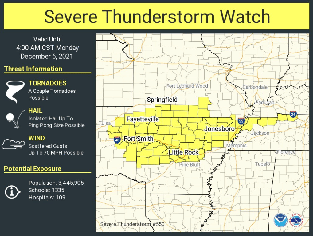
Severe thunderstorm watch is now in effect for most of the northern half of Arkansas until 4 am CST Monday morning.
The National Weather Service in Little Rock commented, “The line of showers and thunderstorms are currently located in northwestern AR making its way to the southeast. This line will continue through Arkansas during the overnight hours. Damaging winds are the primary concern, however, large hail and an isolated tornado cannot be ruled out.”
David Woods of the Sharp County Skywarn/SAR remarked, “The national weather service has issued a special weather statement for our area until 1:15 a.m. . The major concern is high winds of around 60 mph. We will keep you posted on the weather.”
Skywarn/SAR team member Pamela Rowland reports that the Skywarn team was active tonight and said, “The guys are headed out to watch the weather. If anything pops up, we will be here to let you know!”
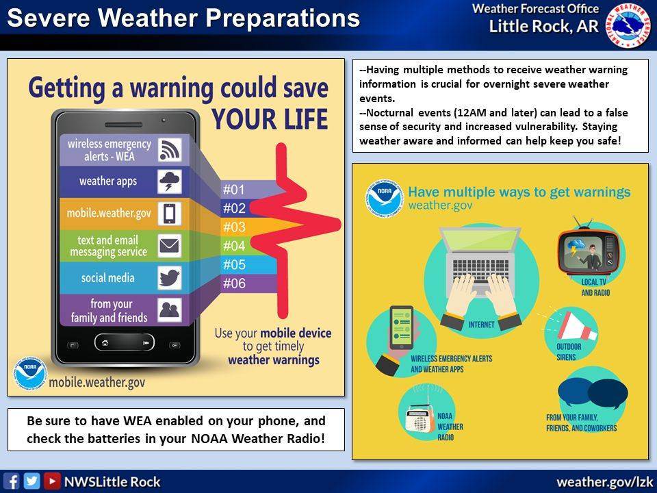
Information and updates from the local Skywarn storm watcher team can be found here. The National Weather Service recommends that you keep your weather radio and cell phone on for alerts and further information during this and any storm.
