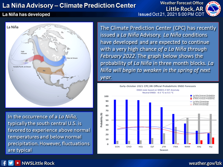
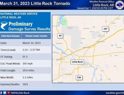
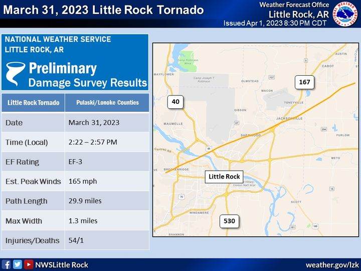
A La Niña has developed in the equatorial Pacific ocean and is expected to continue through the winter and into early next year. As a reminder, a La Niña occurred last winter as well. La Niña is a weather pattern occurring over the Pacific ocean which has a tell tale pattern of effect on the weather throughout the world.
“La Niña means Little Girl in Spanish. La Niña is also sometimes called El Viejo, anti-El Niño, or simply “a cold event.” La Niña has the opposite effect of El Niño. During La Niña events, trade winds are even stronger than usual, pushing more warm water toward Asia. Off the west coast of the Americas, upwelling increases, bringing cold, nutrient-rich water to the surface,” according to the National Oceanographic and Atmostpheric Administration (NOAA).
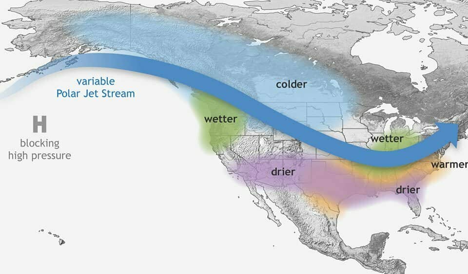
“These cold waters in the Pacific push the jet stream northward. This tends to lead to drought in the southern U.S. and heavy rains and flooding in the Pacific Northwest and Canada. During a La Niña year, winter temperatures are warmer than normal in the South and cooler than normal in the North. La Niña can also lead to a more severe hurricane season.” -NOAA.
According to NOAA, “During La Niña, waters off the Pacific coast are colder and contain more nutrients than usual. This environment supports more marine life and attracts more cold-water species, like squid and salmon, to places like the California coast.”
