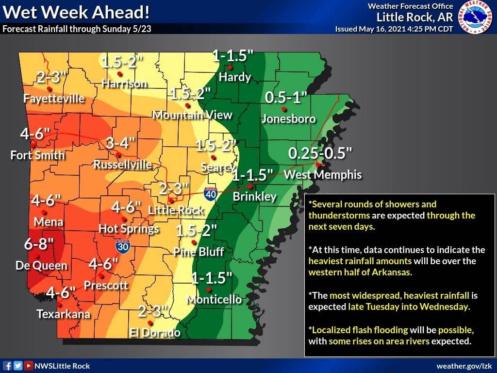
The latest data continues to show multiple rounds of showers and thunderstorms moving through Arkansas over the next seven days.
The heaviest rainfall amounts are expected over the western half of Arkansas, with amounts of three to six inches likely, and localized amounts in excess of six inches not out of the question.
The heaviest, most widespread rainfall is expected late Tuesday into Wednesday.
These rainfall amounts will be over the next seven days, so at this time, the threat of flash flooding is expected to be fairly localized. However, we could see rises on area rivers and streams, especially in the Ouachita, western Arkansas, Fourche Lafave and Saline River basins.
Continue to monitor the latest forecasts, statements and outlooks from your Arkansas National Weather Service Forecast Offices.
