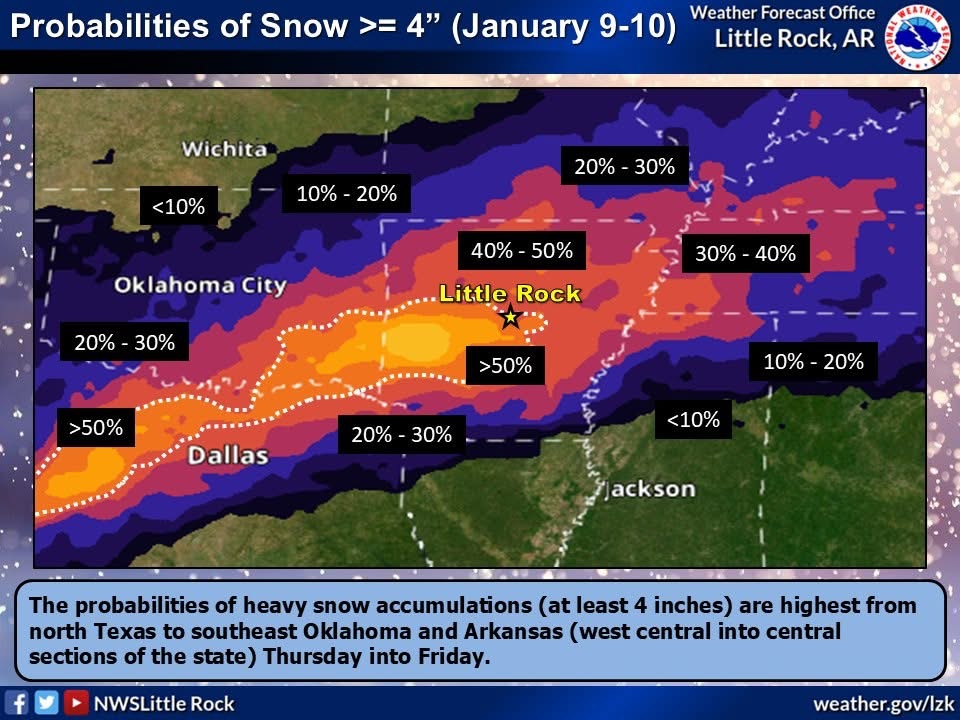
The tri-county area is bracing for its first true blast of winter as snow is forecast to begin falling Jan. 9 through Jan. 10.
According to Eric Green, a forecaster with the National Weather Service snowfall will vary by location, but as of Jan. 7, up to four inches are anticipated to fall.
“A lot of attention and eyes are on the potential of the winter storms later on this week for the Natural State and beyond that parts of the southwest. Leading up to the event, we’ll be dealing with below normal temperatures. Really modulating in the upper 20s to lower 30s later on this week,” Green said. “A winter storm watch is now in effect across northern Arkansas… Coverage of snow is certainly still possible and as of now up to four inches or more. Expansions of that are certainly possible later on today or tomorrow. Right now we’re monitoring a good widespread snowfall for a good bit of the state.”
Green said storms are expected to move into the area Thursday after dark and continue until early Friday afternoon.
“The Main time frame is overnight Thursday after dark you’ll start to see snowfall start and overnight into Friday though the early morning hours, tapering off Friday Afternoon,” Green said. “Temperatures are not expected to improve in terms of getting warmer and these colder temperatures will linger through the weekend. We will see relatively settled conditions just cold weather continuing for the most part.”
Lauren is a an award-winning journalist who decided after 10 years of newspaper experience to venture out. Hallmark Times was born.


