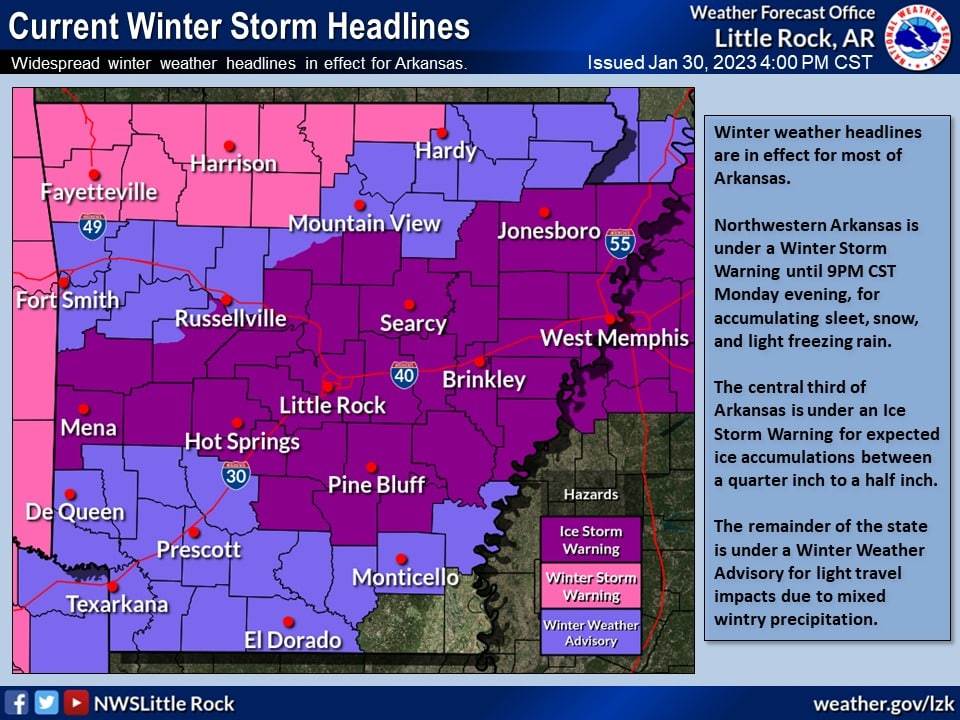
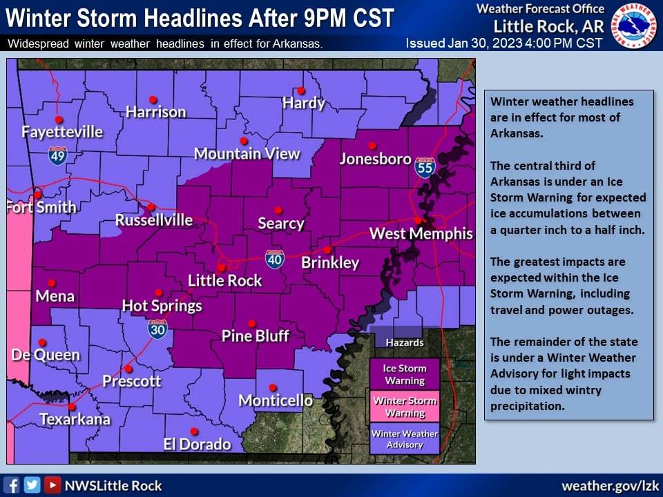
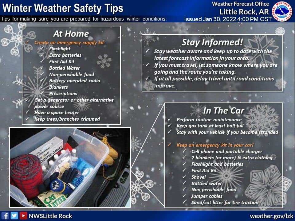
Displayed are the latest advisories and warnings this afternoon from the National Weather Service in Little Rock, AR, as well as an updated ice accumulation map and winter storm safety tips. Key points with this update: the expiration of the northern Winter Storm Warning after 9PM CST, and expansion of the Ice Storm Warning, which is in effect for the central third of Arkansas.
A sleet/snow/freezing rain mix is still ongoing across most of northern Arkansas this evening, and is expected to continue through the later evening hours. Local travel impacts are still ongoing over most of the current Winter Storm Warning area.
Regarding timing of freezing rain, minor accumulations will be possible over central Arkansas through the evening, with a brief break in precipitation likely overnight, and another round of more widespread freezing rain beginning Tuesday afternoon.
The greatest ice accumulations between a quarter inch to one half inch and locally higher amounts are expected within the Ice Storm Warning. This area is also where we expect the greatest impacts to be, including power outages and travel hazards.
For the remainder of the state, minor impacts will be possible due to mixed wintry precipitation over the next day and a half.
